READ

Citizen Army Monitors Coast

When concerned Mid West residents watched the coast erode by their seaside homes, they knocked on the doors of coastal managers and asked how they could help make a difference.
Samille Mitchell
Samille Mitchell
Freelance journalist
Citizen Army Monitors Coast
Image credit: NACC

So great was the demand to contribute that the Northern Agricultural Catchments Council (NACC) got to thinking: how could community volunteers help?

The answer was simple: they could monitor the coastline.

But how? With their smartphones, of course.

NACC had an app developer create the photo monitoring app Photomon. The app enables volunteers to take photos on their smartphones to record coastal erosion. By comparing pictures taken at the same site over time they can see exactly how far the coast has eroded and in what manner the erosion occurs.

ARMY OF VOLUNTEERS

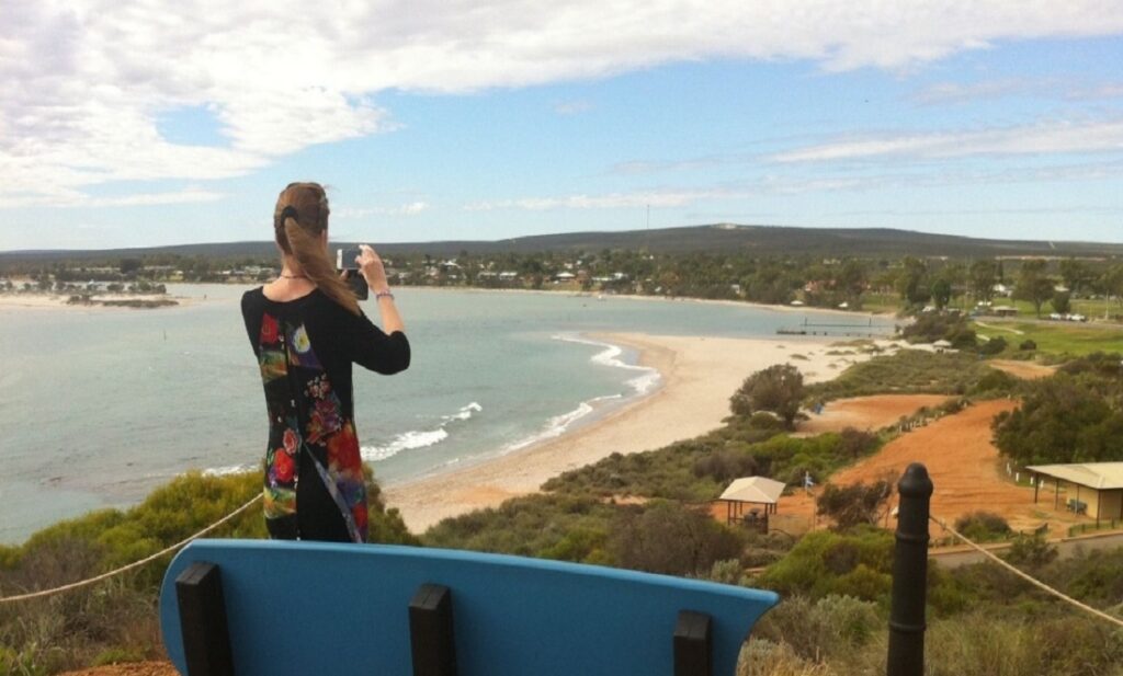
Since the project started in 2013, an army of community volunteers has snapped more than 10,000 photos at about 100 sites stretching from Guilderton to Kalbarri

NACC coastal and marine program coordinator Dr Mic Payne says the information has proven invaluable in helping land managers plan for rising sea levels and receding coastlines.

He says coastal erosion is an increasing problem with rising sea levels and more intense storms associated with climate change.

“If we were to travel around the country monitoring every site from Guilderton to Kalbarri we’d be there forever,” Mic says.

“But this way we’ve got the information waiting for us in one central database.”

View Larger

Photomon app in use on Kalbarri coastline.

Image credit: NACC
Photomon app in use on Kalbarri coastline.

HOW DOES IT WORK?

The app works by using a reference photo — the first photo taken at the site — as a baseline shot that appears as a transparent image. This enables the volunteer to frame the shot in the same place as before.

“That way if anything’s changing, it’s easily apparent in the frame that you’re monitoring,” Mic says.

“In the case of beaches you might see the line of erosion start here and later on it’s here and then here — you can see exactly how it’s changed over time.”

The photos automatically upload to a database, along with the date, time and location.

There’s no need to manually upload them to a computer and label them.

Once uploaded, land managers can physically see the changes in coastline at particular times of the year, and the extent of erosion after storms.

TRIALS AND TRIUMPHS

While many of the volunteers were retired and initially not very smart-phone savvy, Mic says they soon learned how to use the app.

“We had lots of funky photos coming into the database the start — thumbs over the lens and that kind of thing,” Mic laughs.

“But after the training period, they’ve become invaluable helpers.”

So successful was Photomon in monitoring coastline, the app is now being used to monitor weed control and revegetation sites.

NACC is now developing Photomon Services for use by Natural Resource Management organisations.

Anyone interested in Photomon Services can contact NACC’s Photomon Services Officer Tegan Clarke.

Samille Mitchell
About the author
Samille Mitchell
Samille Mitchell is a long-time freelance journalist. She has authored four non-fiction books and penned countless environment, science, travel, news and human interest articles. She also founded and publishes Inspired Magazine. Samille loves the way science reveals the seemingly magical workings of nature.
View articles

NEXT ARTICLE

We've got chemistry, let's take it to the next level!

Get the latest WA science news delivered to your inbox, every fortnight.

Republish

Creative Commons Logo

Republishing our content

We want our stories to be shared and seen by as many people as possible.

Therefore, unless it says otherwise, copyright on the stories on Particle belongs to Scitech and they are published under a Creative Commons Attribution-NoDerivatives 4.0 International License.

This allows you to republish our articles online or in print for free. You just need to credit us and link to us, and you can’t edit our material or sell it separately.

Using the ‘republish’ button on our website is the easiest way to meet our guidelines.

Guidelines

You cannot edit the article.

When republishing, you have to credit our authors, ideally in the byline. You have to credit Particle with a link back to the original publication on Particle.

If you’re republishing online, you must use our pageview counter, link to us and include links from our story. Our page view counter is a small pixel-ping (invisible to the eye) that allows us to know when our content is republished. It’s a condition of our guidelines that you include our counter. If you use the ‘republish’ then you’ll capture our page counter.

If you’re republishing in print, please email us to let us so we know about it (we get very proud to see our work republished) and you must include the Particle logo next to the credits. Download logo here.

If you wish to republish all our stories, please contact us directly to discuss this opportunity.

Images

Most of the images used on Particle are copyright of the photographer who made them.

It is your responsibility to confirm that you’re licensed to republish images in our articles.

Video

All Particle videos can be accessed through YouTube under the Standard YouTube Licence.

The Standard YouTube licence

  1. This licence is ‘All Rights Reserved’, granting provisions for YouTube to display the content, and YouTube’s visitors to stream the content. This means that the content may be streamed from YouTube but specifically forbids downloading, adaptation, and redistribution, except where otherwise licensed. When uploading your content to YouTube it will automatically use the Standard YouTube licence. You can check this by clicking on Advanced Settings and looking at the dropdown box ‘License and rights ownership’.
  2. When a user is uploading a video he has license options that he can choose from. The first option is “standard YouTube License” which means that you grant the broadcasting rights to YouTube. This essentially means that your video can only be accessed from YouTube for watching purpose and cannot be reproduced or distributed in any other form without your consent.

Contact

For more information about using our content, email us: particle@scitech.org.au

Copy this HTML into your CMS
Press Ctrl+C to copy