We’ve been putting stuff in space for over 60 years now. Without air resistance to slow it down, it tends to stay up there—even if it’s not meant to.
The space above our planet is slowly filling with dead satellites, rocket parts, nuts and bolts and even chips of paint, all moving at thousands of kilometres an hour. At those speeds, even the tiniest collision can cause massive damage, and the more there is, the harder it is to dodge.
But not only are there no laws of physics bringing them down—there are no human laws about them either.
“It’s a classic tragedy of the commons,” says Anthony Wicht, space expert at United States Studies Centre. “But unlike deforestation or overfishing, nobody can see it.”
So what can we do about it?
The best we can do at the moment is get a better idea of exactly what’s up there and where it is. If we know where debris is, we can steer satellites out of the way. It’s only when we lose track of things that they become a risk.
Learning how to track space debris is a growing field called ‘space situational awareness’, and WA is getting pretty good at it.
Not only do we host part of the Falcon Telescope Network and some super-secret USAF/NASA radar sites, our homegrown Desert Fireball Network has become an unexpectedly important player as well.
The Desert Fireball Network is made up of 52 automated cameras spread across the country. They’re designed to track meteors entering Earth’s atmosphere, with help from citizen scientists. But that’s not all they’ve been tracking.
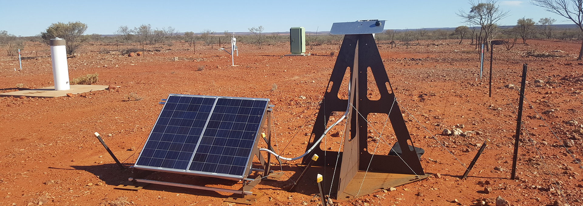
“We realised early on that we weren’t just seeing meteorites,” says Renae Sayers, Research Ambassador for Curtin University. “We were picking up other moving objects in the sky as well.”
Using images from the cameras and a little bit of maths, the Desert Fireball Network team built up a stunningly accurate map of all the stuff up in orbit around the Earth.
“We have so many sensors that you see the same object every couple of hours,” Renae says. “There’s no need to do any fancy orbit calculations if you never lose an object in the first place.”
“[The map] ended up being accurate down to about one pixel. If the object was more than a pixel out of place, we knew that its orbit had changed,” says Professor Phil Bland, project lead.
They’re now working with aerospace company Lockheed Martin to roll the mapping system out across the world.
“It’s a great example of how blue-sky space science projects can rapidly translate into real benefits for Australian space industries and defence,” Professor Bland says.
Be aware and take care
Situational awareness lets us avoid collisions and move satellites out of the way. In the future, it might be possible to remove space debris entirely. We might use the satellite equivalent of a rubbish truck or shoot it down with a laser from Earth.
Until then though, the best we can do is keep track of the problem—and remember to clean up after ourselves in space, just like we do here on Earth.
