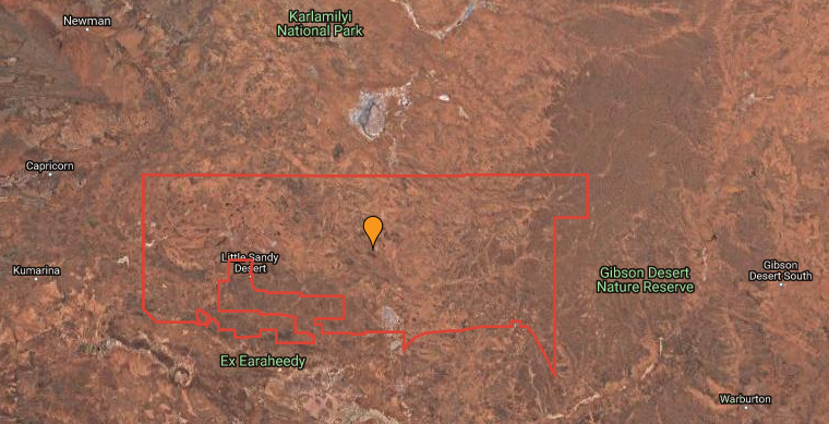
If you take a map of Western Australia and poke your finger right in the middle, that’s about where Birriliburu is.
Found to the southeast of Newman, the Birriliburu Indigenous Protected Area (BIPA) is filled with amazing geographical sights.
With sand dunes and sandstone mountain ranges to salt lakes and claypans, the region covers parts of both the Little Sandy and Gibson Deserts.
This huge swath of land is managed by the Birriliburu rangers.

Preserving heritage
The Birriliburu rangers have been managing the area since 2013, continuing a tradition that stretches back 25,000 years.
But to continue protecting and preserving such a large area, the rangers aren’t keeping their traditional knowledge to themselves.
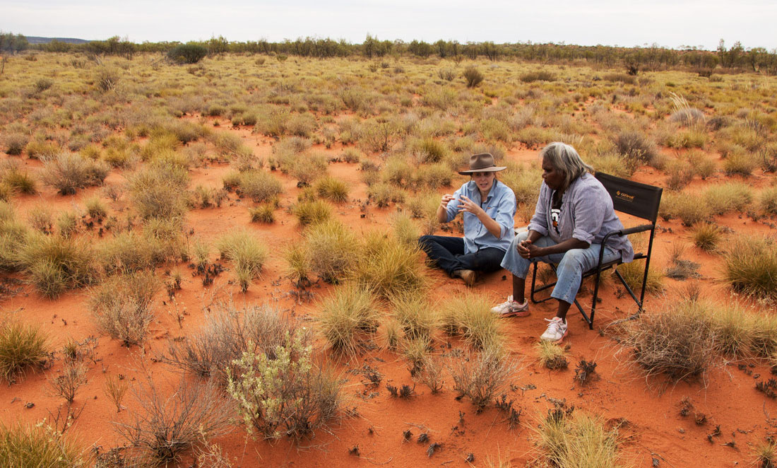
They’re working alongside scientists, teaching them stories and language, how to read country and how to identify tracks and scats.
The scientists, for their part, have introduced the rangers to the latest monitoring technologies.
It’s part of a relationship between the Birriliburu Traditional Owners, Bush Heritage Australia and Desert Support Services to protect the plants, animals and landscapes of the region.
On Country
Birriliburu’s Traditional Owners are the Martu, and their traditional, ecological and cultural knowledge stretches back more than 25,000 years.
Birriliburu covers an area almost the size of Tasmania, and it was declared an Indigenous Protected Area in 2013.
Responding to Particle as a collective, the Birriliburu rangers say Martu have a strong connection to their country.
“Many of the elders were born on country,” they say.
“[The elders] hold immense knowledge about Tjukurrpa (Dreamtime stories), special places, food plants, language, family connections and so much more.”
Burning the bush
One activity very important to Martu is waru (fire) management.
The rangers conduct management burns to protect special places, look after threatened species and encourage the growth of edible plants.
The controlled burns also prevent large wildfires from burning large areas of country.
Each year, the team maps fire scars to show the patchwork of burns they have created.
“We can even show where ranger burns from one year have stopped the spread of a large wildfire the following year,” the rangers say.
Animal tracks
The rangers are also experts at monitoring muntulngaku (bilbies).
They know where to look and how to identify the tracks and scats of the illusive creatures, which are important indicators of the health of country.
The rangers also monitor species such as the great desert skinks and the night parrot, using new technology.
At the same time, they’re drawing on traditional tracking skills to monitor feral cats and foxes.
“The Birriliburu rangers have learned how to use some of the new technologies, particularly data collecting using apps such as Fulcrum, setting up motion sensor camera traps and sound records,” the rangers say.
“Rangers have also given presentations at national scientific conferences about their work.”
Bush grub
Alongside the monitoring of fauna, the Birriliburu rangers have been creating a database of mirrka (bush tucker), with more than 90 species catalogued.
“The database stores information such as the Martu names, scientific names, uses, specimens and photos,” the rangers say.
So of course, there was a lesson on how to make a proper cup of tea and damper.


